LARIAC Data Access
Faculty Access
The LARIAC 7 data is currently available for faculty use in research and education. You will find access steps below and when you've successfully connected, please download data to your local machine as needed. Though this data is intended for faculty distribution, we are currently evaluating access for students at a future data.
*This LARIAC data contains high resolution imagery but is incomplete. We are waiting on delivery of LIDAR files.
Login Steps
From Campus on your Work Computer
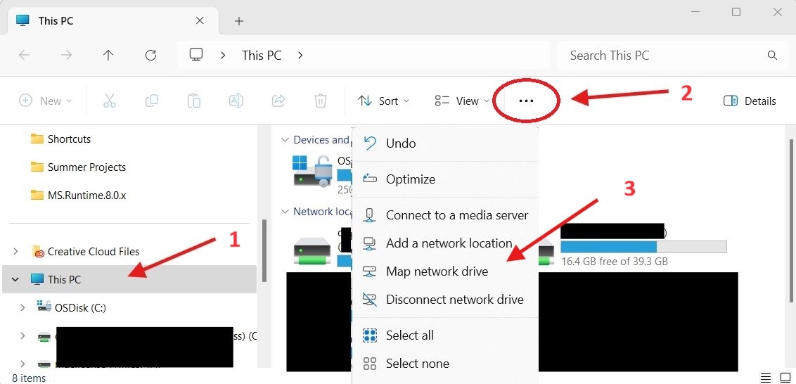
- First Open any folder/explorer window and select “This PC” on the left. Then find the option “Map network drive” and select it. You’ll find this setting by clicking the ellipsis in Windows 11.
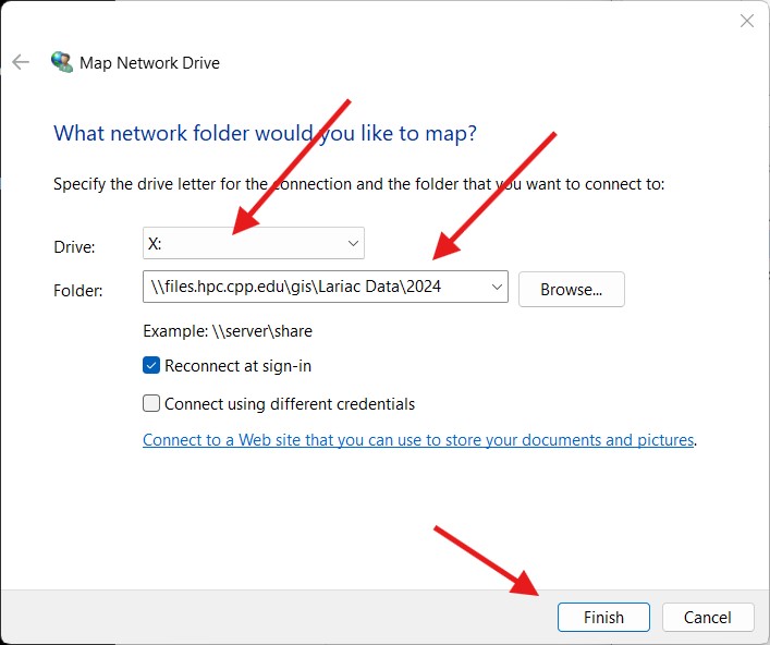
- In the window that pops up, leave the drive letter as default but insert the following text into the ‘Folder’ field as seen in the image below (copy & paste):
\\files.hpc.cpp.edu\gis\Lariac Data\2024 - Click finish when done and repeat these steps to add one more drive using the text below (copy & paste):
\\files.hpc.cpp.edu\gis\Lariac Data\2024-2
Off Campus on your Work Computer
- You will need to be sure you are connected to the CPP network through your VPN using GlobalProtect
- Once connected you may follow the previous steps to add the network drives and download data.
- If you do not have the CPP VPN installed, you can review the KB article here