Educational Partnership Takes Collaboration to new Heights
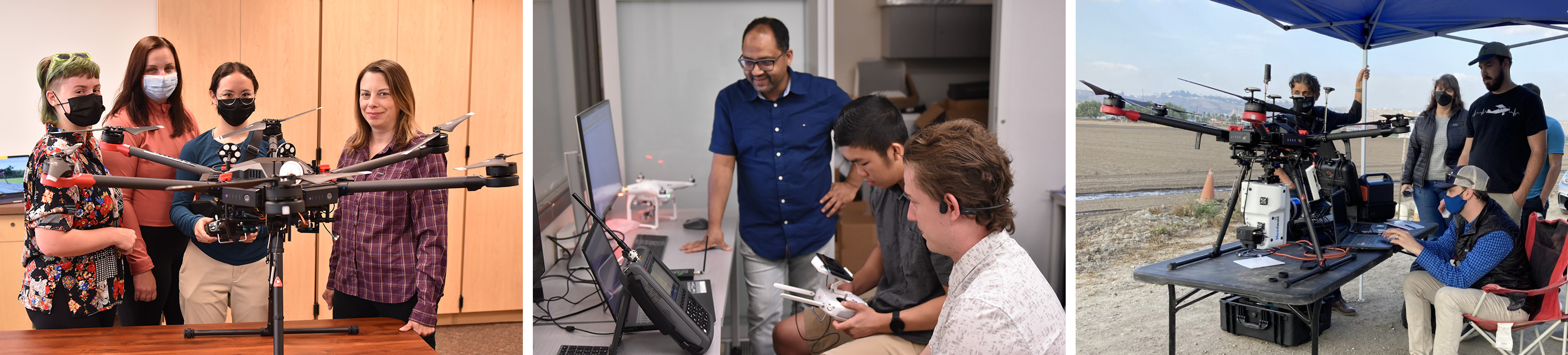
Since 2005, Cal Poly Pomona’s Educational Partnership Agreement (EPA) with the Air Force Research Lab (AFRL) has enhanced the educational experience of our students by providing exceptional hands-on learning opportunities. CPP received $4.85 million for FY21 that is funding seven projects involving 17 faculty from nine departments across five colleges. This innovative multidisciplinary collaboration is providing enormous opportunities to students. They will use state of the art unmanned aerial and ground vehicles (UAV & UGV) equipped with advanced sensors. Alison Baski who is College of Science Dean and Interim College of Engineering Dean is the Principal Investigator on the CPP grant. Thanks to efforts by Rep. Norma Torres (D-35), Rep. Grace Napolitano (D-32), and Rep. Salud Carbajal (D-24), Cal Poly Pomona, in partnership with Cal Poly San Luis Obispo, has received funding for our campus to advance our EPA with the AFRL for multi-disciplinary projects involving faculty from colleges across the institution. Through this transformative funding, our students have access to state-of-the-art equipment, conduct leading edge research, and gain experience that prepares them to meet challenges and become leaders in the workplace.
Advanced sensors that cost up to $250,000 make it possible to acquire accurate and incredibly detailed data.
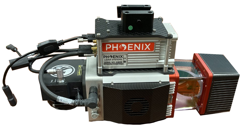
LiDAR
Laser pulses are used to measure terrain, allowing scientists to create 3D maps of surface features and vegetation. This data will be used by geologists for geohazard research and biologists for habitat monitoring and restoration.
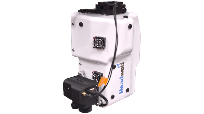
Hyperspectral
UAV mounted hyperspectral sensors allow researchers to identify the chemical composition of materials. Geologists will be able to determine the mineral composition of terrain and the presence of water. Biologists and plant scientists will be able to identify different plant species and even determine the health of those plants.
This collaborative research brings together 17 faculty across five colleges and nine departments.
COLLEGES - DEPARTMENTS
Science – Computer Science, Biological Sciences, Geological Sciences
Engineering – Aerospace, Electrical and Computer, Civil
Agriculture – Plant Science
Business – Computer Information Systems
Letters, Arts & Social Sciences – Geography
Three Projects the College of Science is Leading:
Remote Sensing for Habitat Restoration
This project will collect data on plants, temperature, and terrain that will guide restoration after fires.
Geohazards Analysis
This project will enable the creation of 3D maps of terrain and the ability to see subsurface faults and movements.
Communication Systems for Emergency Networks and Cybersecurity
This research will provide first-responders with techniques to launch 5G airborne communication networks when disasters affect infrastructure. Cybersecurity research will focus on the detection and mitigation of harmful UAV’s such as unauthorized drones flying in disaster response airspace.